Save money on our full line of wall maps from one of the industry leaders in wall maps. These always up to date, eye catching wall maps come in a variety of sizes and finishing options sure to meet your specific mapping needs. Features include: Interstate Us State Highways 5-Digit ZIP Codes County Names and…
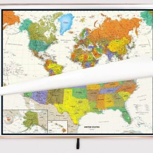
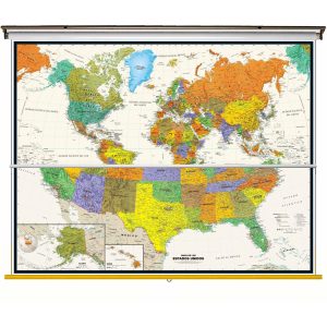
Size: 40 h x 63 w Finishing: Spring Roller Includes 2 Maps on One Spring Roller! Perfect for home, business, or school, this Contemporary USA Wall Map combines warm, attractive colors with high-detailed cartography. Details on this United States Wall Map include state boundaries and capitals along with other major cities and towns; major physical features such…
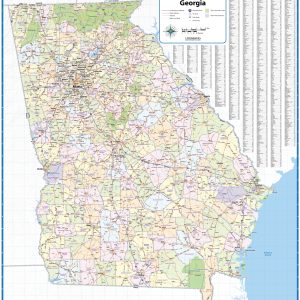
This wall map of Georgia shows counties, towns, cities, and major highways. Recently updated, this basic map is a great tool for visualizing the entire state for planning purposes, territory management, or allocating resources. This map is shipped rolled in a study tube. This map is rolled and shipped in a sturdy cardboard tube.
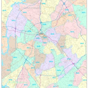
This wall map of the Greater Salt Lake City Metro area showing locations within 30 miles of downtown Salt Lake City, including parts of Salt Lake, Davis, Morgan, Summit, Weber Wasatch, and Utah Counties. Communities included are Salt Lake City, Ogden, Layton, Bountiful, Sandy, Lehi, Orem, Park City, and Provo, among others. Features shown include cities, towns,…
Size: 40 h x 63 w Finishing: Spring Roller Includes 2 Maps on One Spring Roller! Perfect for home, business, or school, this Contemporary USA Wall Map – Spanish Version combines warm, attractive colors with high-detailed cartography. Details on this United States Wall Map include state boundaries and capitals along with other major cities and towns;…
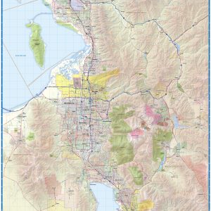
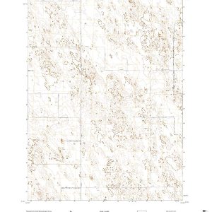
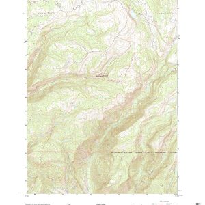
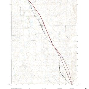
This is the current USGS topographic map for this quadrangle. Printed on waterproof and crease resistant paper, using HP fade resistant inks, this map comes rolled and shipped in a sturdy carboard tube. The map contains contour data, water features, roads and other features. Scale is 1:24,000. Printed size is 24 W x 29 H
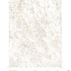
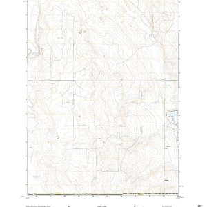
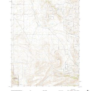
This is the current USGS topographic map for this quadrangle. Printed on waterproof and crease resistant paper, using HP fade resistant inks, this map comes rolled and shipped in a sturdy carboard tube. The map contains contour data, water features, roads and other features. Scale is 1:24,000. Printed size is 24 W x 29 H
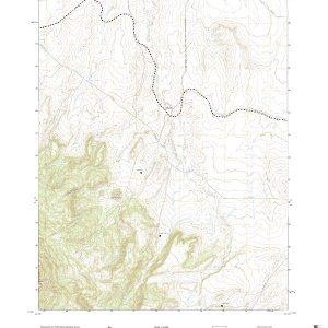
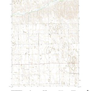
This is the current USGS topographic map for this quadrangle. Printed on waterproof and crease resistant paper, using HP fade resistant inks, this map comes rolled and shipped in a sturdy carboard tube. The map contains contour data, water features, roads and other features. Scale is 1:24,000. Printed size is 24 W x 29 H
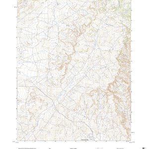
This is the current USGS topographic map for this quadrangle. Printed on waterproof and crease resistant paper, using HP fade resistant inks, this map comes rolled and shipped in a sturdy carboard tube. The map contains contour data, water features, roads and other features. Scale is 1:24,000. Printed size is 24 W x 29 H
This is the current USGS topographic map for this quadrangle. Printed on waterproof and crease resistant paper, using HP fade resistant inks, this map comes rolled and shipped in a sturdy carboard tube. The map contains contour data, water features, roads and other features. Scale is 1:24,000. Printed size is 24 W x 29 H
This is the current USGS topographic map for this quadrangle. Printed on waterproof and crease resistant paper, using HP fade resistant inks, this map comes rolled and shipped in a sturdy carboard tube. The map contains contour data, water features, roads and other features. Scale is 1:24,000. Printed size is 24 W x 29 H
This is the current USGS topographic map for this quadrangle. Printed on waterproof and crease resistant paper, using HP fade resistant inks, this map comes rolled and shipped in a sturdy carboard tube. The map contains contour data, water features, roads and other features. Scale is 1:24,000. Printed size is 24 W x 29 H
This is the current USGS topographic map for this quadrangle. Printed on waterproof and crease resistant paper, using HP fade resistant inks, this map comes rolled and shipped in a sturdy carboard tube. The map contains contour data, water features, roads and other features. Scale is 1:24,000. Printed size is 24 W x 29 H
This is the current USGS topographic map for this quadrangle. Printed on waterproof and crease resistant paper, using HP fade resistant inks, this map comes rolled and shipped in a sturdy carboard tube. The map contains contour data, water features, roads and other features. Scale is 1:24,000. Printed size is 24 W x 29 H
This is the current USGS topographic map for this quadrangle. Printed on waterproof and crease resistant paper, using HP fade resistant inks, this map comes rolled and shipped in a sturdy carboard tube. The map contains contour data, water features, roads and other features. Scale is 1:24,000. Printed size is 24 W x 29 H
This is the current USGS topographic map for this quadrangle. Printed on waterproof and crease resistant paper, using HP fade resistant inks, this map comes rolled and shipped in a sturdy carboard tube. The map contains contour data, water features, roads and other features. Scale is 1:24,000. Printed size is 24 W x 29 H